Active AlertsAnderson Ways, TX
Severe Thunderstorm Watch
Issued at Tue 11:06 AM May. 28
Issued by: National Weather Service
Description
Full details
Severe Thunderstorm Warning
Issued at Tue 1:22 PM May. 28
Issued by: National Weather Service
Recommended Action
For your protection move to an interior room on the lowest floor of abuilding.
Description
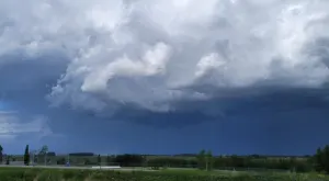
At 122 PM CDT, severe thunderstorms were located along a lineextending from 7 miles north of Hardin to East Little York /Homestead to Westchase, moving southeast at 50 mph.HAZARD...70 mph wind gusts and quarter size hail.SOURCE...Radar indicated.IMPACT...Hail damage to vehicles is expected. Expect considerabletree damage. Wind damage is also likely to mobile homes,roofs, and outbuildings.Locations impacted include...Pasadena, Pearland, League City, northeastern Sugar Land, Baytown,Missouri City, Texas City, Friendswood, La Porte, Deer Park, Alvin,Dickinson, Stafford, South Houston, Bellaire, Humble, West UniversityPlace, La Marque, Santa Fe, and Seabrook.
More News from The Weather Network


Advertisement
Advertisement
Advertisement