Active AlertsNeuville, TX
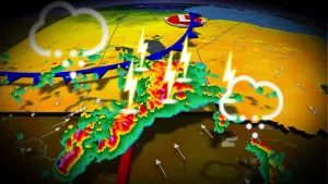
THE NATIONAL WEATHER SERVICE WILL ALLOW SEVERE THUNDERSTORM WATCH380 TO EXPIRE NOW AT 12:30 A.M. CDT A LITTLE EARLY THIS MORNINGFOR THE FOLLOWING AREASIN ARKANSAS THIS ALLOWS TO EXPIRE 1 COUNTYIN SOUTH CENTRAL ARKANSASUNIONIN LOUISIANA THIS ALLOWS TO EXPIRE 14 PARISHESIN NORTH CENTRAL LOUISIANACALDWELL GRANT JACKSONLA SALLE LINCOLN OUACHITAUNION WINNIN NORTHWEST LOUISIANABIENVILLE CLAIBORNE DE SOTONATCHITOCHES RED RIVER SABINEIN TEXAS THIS ALLOWS TO EXPIRE 6 COUNTIESIN NORTHEAST TEXASANGELINA CHEROKEE NACOGDOCHESSABINE SAN AUGUSTINE SHELBYTHIS INCLUDES THE CITIES OF ARCADIA, BERNICE, CENTER, CLARKS,COLFAX, COLUMBIA, COUSHATTA, DRY PRONG, EL DORADO, FARMERVILLE,GIBSLAND, GRAYSON, HAYNESVILLE, HEMPHILL, HOMER, JACKSONVILLE,JENA, JONESBORO, LOGANSPORT, LUFKIN, MANSFIELD, MANY, MARTIN,MIDWAY, MONROE, MONTGOMERY, NACOGDOCHES, NATCHITOCHES, OLLA,PINELAND, PLEASANT HILL, RINGGOLD, RUSK, RUSTON, SAN AUGUSTINE,STONEWALL, WINNFIELD, AND ZWOLLE.
Do not drive cars through flooded areas.The next statement will be issued Monday morning at 1030 AM CDT.
...The Flood Warning is extended for the following rivers in Texas...Attoyac Bayou Near Chireno affecting Shelby, San Augustine, Ruskand Nacogdoches Counties.For the Attoyac Bayou...including Chireno...Minor flooding isforecast.* WHAT...Minor flooding is forecast.* WHERE...Attoyac Bayou near Chireno.* WHEN...Until Thursday morning.* IMPACTS...At 16.0 feet, Expect flooded paths and secondaryroadways. Move livestock and equipment to higher ground.* ADDITIONAL DETAILS...- At 9:30 AM CDT Sunday the stage was 13.7 feet.- Bankfull stage is 14.0 feet.- Forecast...The river is expected to rise above flood stagethis afternoon to a crest of 15.2 feet early Tuesday morning.It will then fall below flood stage early Wednesdayafternoon.- Flood stage is 14.0 feet.