Relief, at last: Why Alberta welcomes 80 mm of rainfall this week

Parts of Alberta finally got some much-needed relief for its ongoing drought this week. In fact, enough rain fell in a 24-hour period to break a 123-year-old, daily May record in Medicine Hat, Alta., on Tuesday
Records are made to be broken all the time, but this Alberta community held onto a daily rainfall accolade for 123 years before it fell.
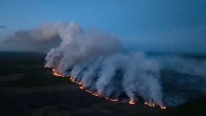
This week was particularly wet for the Prairies, not just Alberta, an event that was badly needed for a region stricken with drought, and vulnerable to wildfires for some areas.
For Medicine Hat, Alta., the multi-day affair saw a new, daily May rainfall record, usurping a total that had been in place since 1901.
SEE ALSO: 'Multimillion-dollar rain' revives soil in Saskatchewan south before farm season
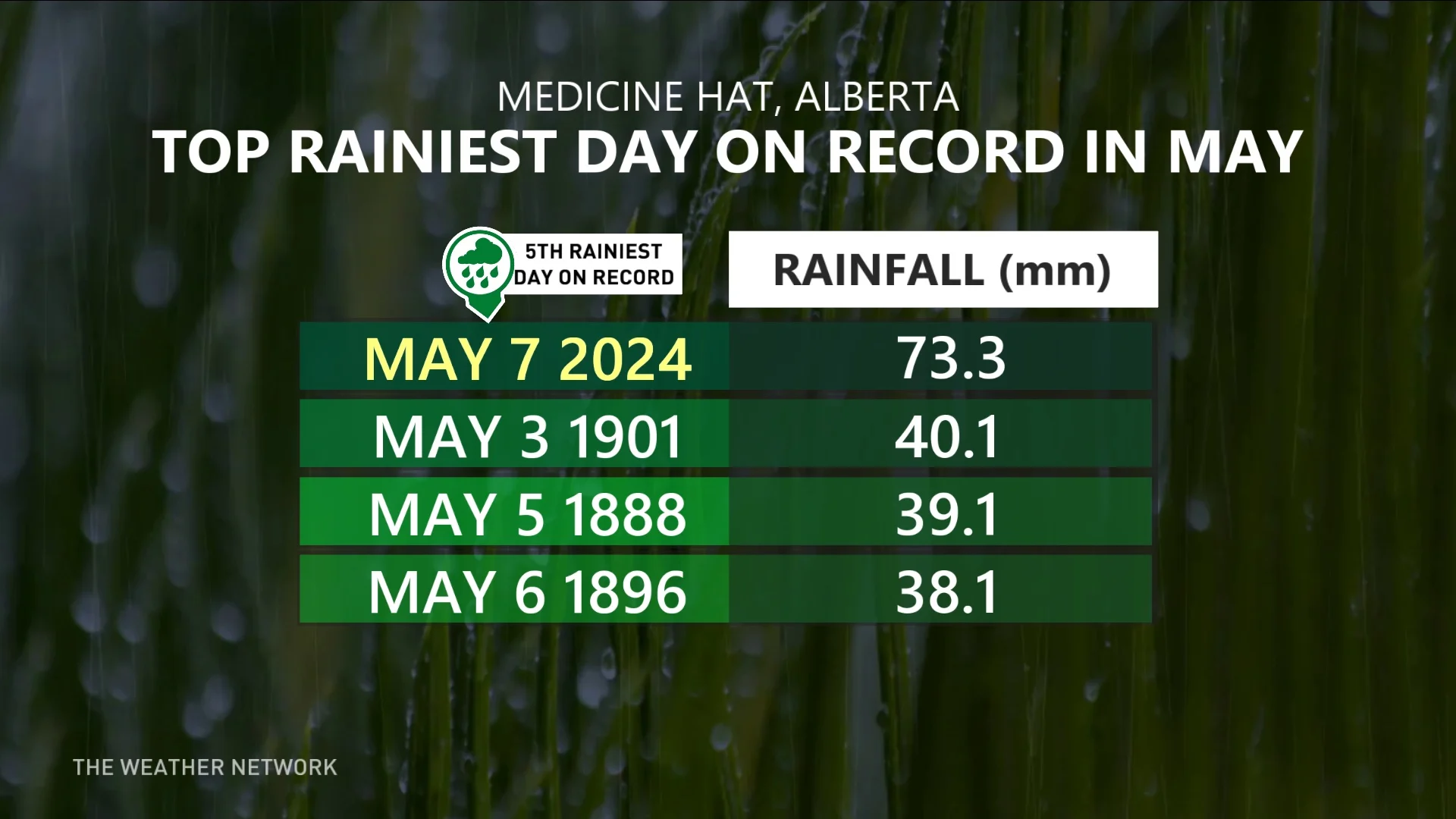
On Tuesday, May 7, the community experienced its largest, single-day rainfall event for the month with 73.3 mm recorded. It easily bested its previous daily record in the month, a total of 40.1 mm of rain set on May 3, 1901.
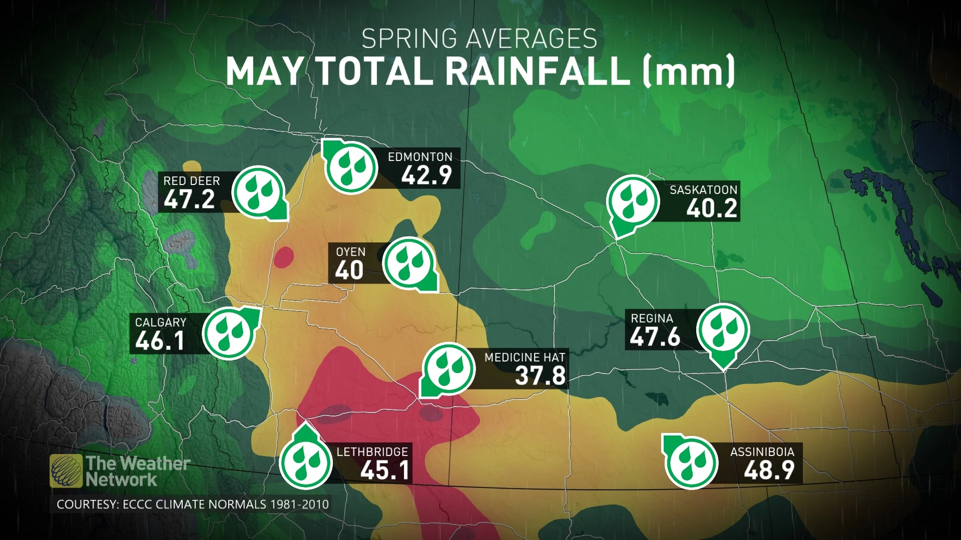
It was enough to make it the community's fifth rainiest day in history. Medicine Hat’s average rainfall for May is roughly 38 mm.
The prolonged period of rainfall was noteworthy for many areas in the province, not just Medicine Hat.
In some regions, two month's worth of rain fell in a single day.
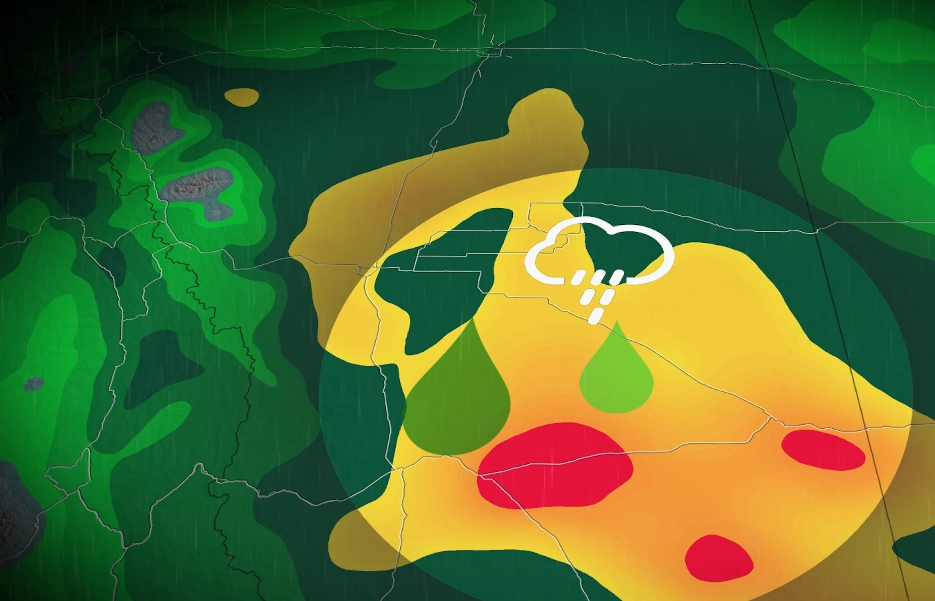
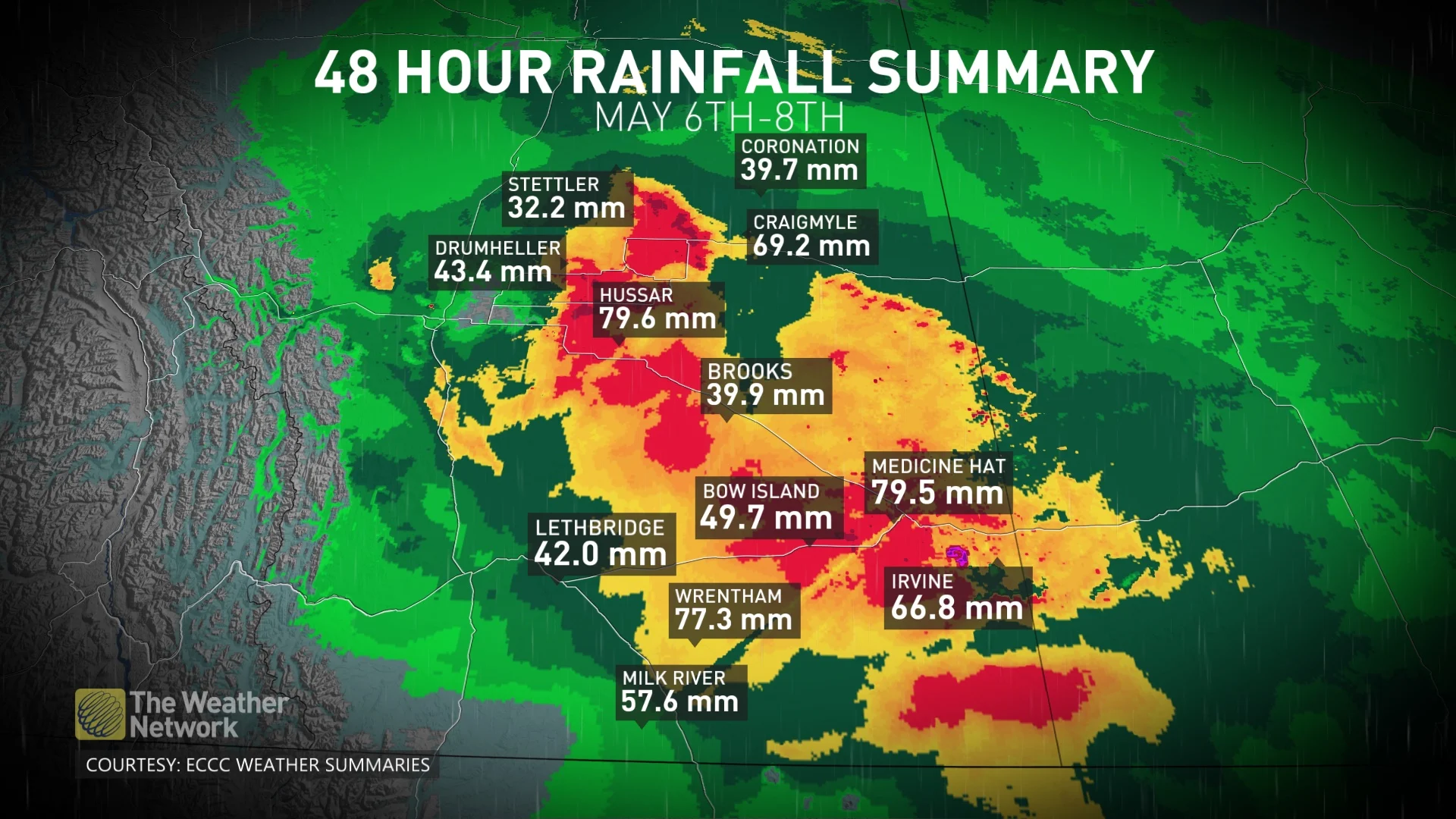
Here is a look at just some of the two-day rainfall accumulations across the province, with information released by Environment and Climate Change Canada (ECCC) as of 5 a.m. local time on May 8. These totals could change.
Pinhorn: 81 mm
Hussar: 79.6 mm
Medicine Hat: 79.5 mm
Atlee: 78.5 mm
Wrentham: 77.3 mm
Craigmyle: 69.2 mm
Buffalo: 68.5 mm
Raymond: 67.7 mm
Irvine: 66.8 mm
Fincastle: 66.1 mm
Seven Persons: 64.6 mm
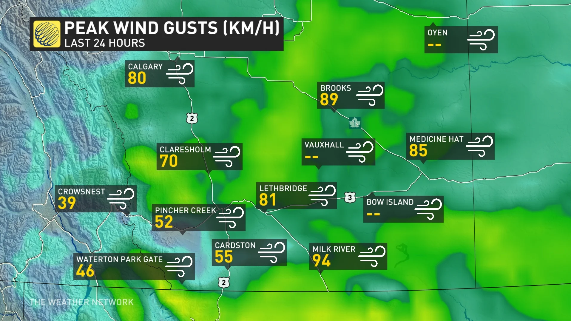
As if the rain wasn't enough, the province also experienced blustery wind gusts, leading to reports of localized damage.
Wind gusts exceeding 100 km/h were documented in some areas closer to the international border. A tally of 106 km/h was the strongest gust documented on May 7, as it blew in colder air from the north.
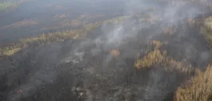
Speaking of the northern sections of Alberta, the region missed out on most of the benefits of this system. Parts of northern Alberta remain in high, very high or extreme fire danger ratings.
Fret not, however, as a wet pattern is emerging next week, expected to bring rain to wildfire- and drought-prone regions where it is needed most.
"Cautiously optimistic that we will see a period of wetter weather later next week and beyond across northern Alberta, northern Saskatchewan and into adjacent areas of the N.W.T. –– in areas that have been exceptionally dry, and that have mostly missed out on recent rain," said Dr. Doug Gillham, a meteorologist at The Weather Network.
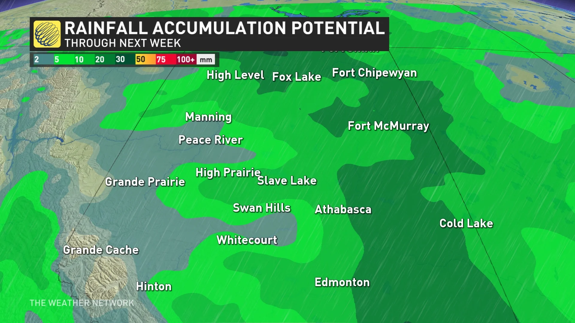
A period of wet weather with significant rain totals will be critical for reducing the wildfire risk in the second half of May, Gillham added.
However, you can have too much of a good thing. Although the rainfall is good for crops, too much of it in a short time could be detrimental to agriculture if it results in flooding.
With files from Laura Power, a meteorologist at The Weather Network.