Holiday weekend in northern Ontario kicks off with severe weather risk
The threat for severe weather will restart in northwestern Ontario on Saturday, an undesired way to kick off the long weekend for those in the region. Included in the risk is a brief, but low chance of a tornado, as well
The Prairies have been seen multiple days of severe weather this week, and now the opportunity moves into northern Ontario as the Victoria Day weekend begins.
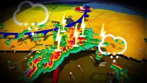
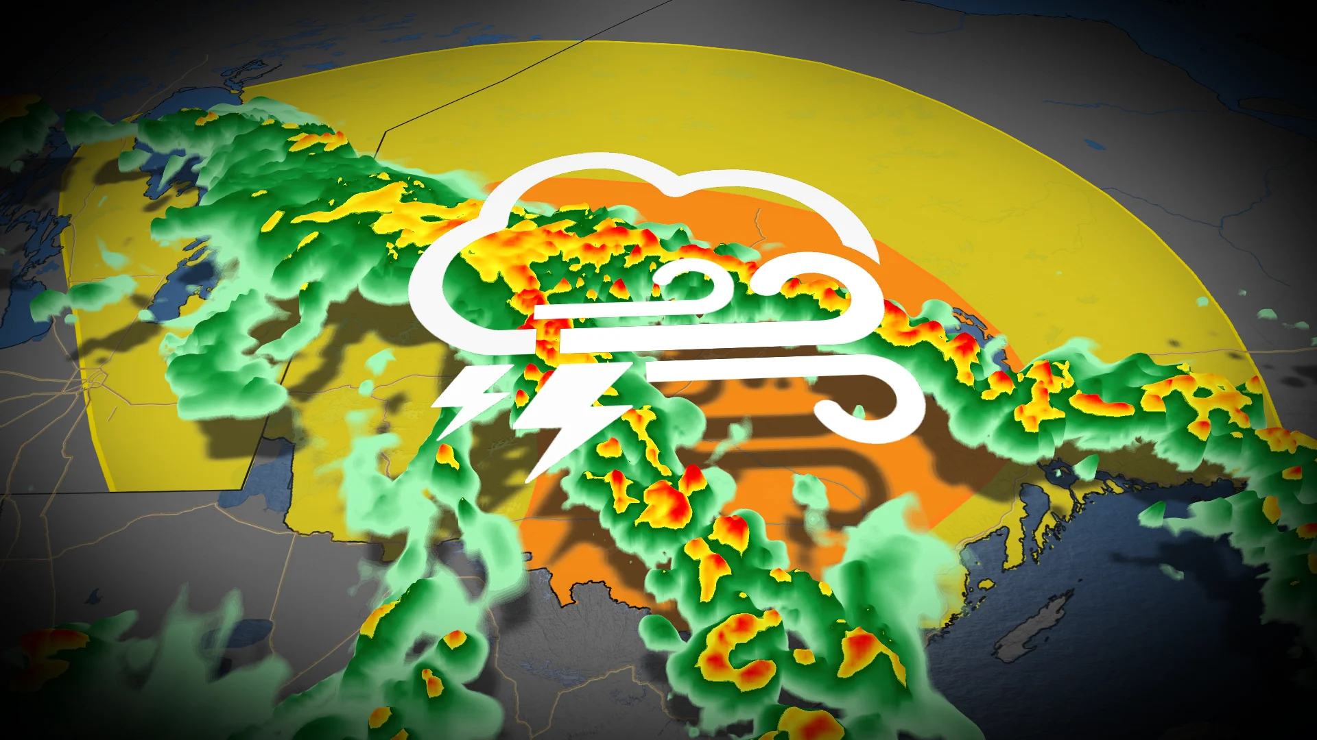
What will be the finale of a multi-day stretch of severe storm potential sees the last of it move into northwestern Ontario Saturday. The opportunity for severe weather includes damaging winds, heavy downpours, large hail and a short, but low risk of a tornado.
DON’T MISS: Warm sunshine, cold rain dominate Canada’s long-weekend forecast
Campers and outdoor enthusiasts will need to be weather-aware and may have to postpone plans. Closely monitor severe weather warnings and stay close to safe shelter in case you have to take cover in a hurry. Make sure you have a way to get weather alerts overnight.
Saturday’s risk pushes into northern Ontario
We’ve got one more day of stormy weather on tap before this bothersome low-pressure system finally scoots out of the region.

Southerly winds will help push some instability into northern Ontario during the day Saturday, providing the fuel needed to power any thunderstorms sparked by a front advancing across the region.
MUST SEE: Stuck in your car during a tornado? Here’s what you should do
A line of thunderstorms is expected to develop east of Dryden into the afternoon and evening hours on Saturday. Dynamics are in place for some of the storms in northern Ontario to turn severe.

The stronger storms that pop up could produce damaging winds, heavy rainfall, and large hail. There’s a low risk that one or two of these storms may briefly rotate and produce an embedded tornado.
Saturday’s overall risk for severe weather is a little uncertain, though, and storms may turn out weaker than expected. As always, it’s best to prepare for stormy weather for naught than to get caught by surprise when threatening clouds loom.
Those in the affected risk areas are urged to stay alert for the latest weather warnings and to have a plan in place in case severe weather threatens. Conditions can change quickly when severe weather hits.

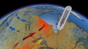
Long weekend chill dominates the Prairies
Expect a chilly and soggy pattern to dominate the Prairies heading into the long holiday weekend.
While Manitoba will start the weekend on a milder note, a broad trough digging over the centre of the country will bring below-seasonal temperatures and widespread rain through the holiday.

Precipitation moving into the northern Prairies is fantastic news for areas battling ongoing wildfires. Between 30-50 mm of beneficial rain is forecast.
Check back for all the latest on your forecast across the Prairies.